
Abrolhos Island management and maps
The Houtman Abrolhos Islands were declared a Class A Reserve in 1929 in recognition of its important recreational and tourism values. Reef observation areas were created in 1994 and state waters surrounding the islands were gazetted as a fish habitat protection area (FHPA) in 1999.
The purpose of the FHPA is the:
- conservation and protection of fish, fish breeding areas, fish fossils or the aquatic eco-system
- culture and propagation of fish and experimental purposes related to that culture and propagation
- management of fish and activities relating to the appreciation or observation of fish.
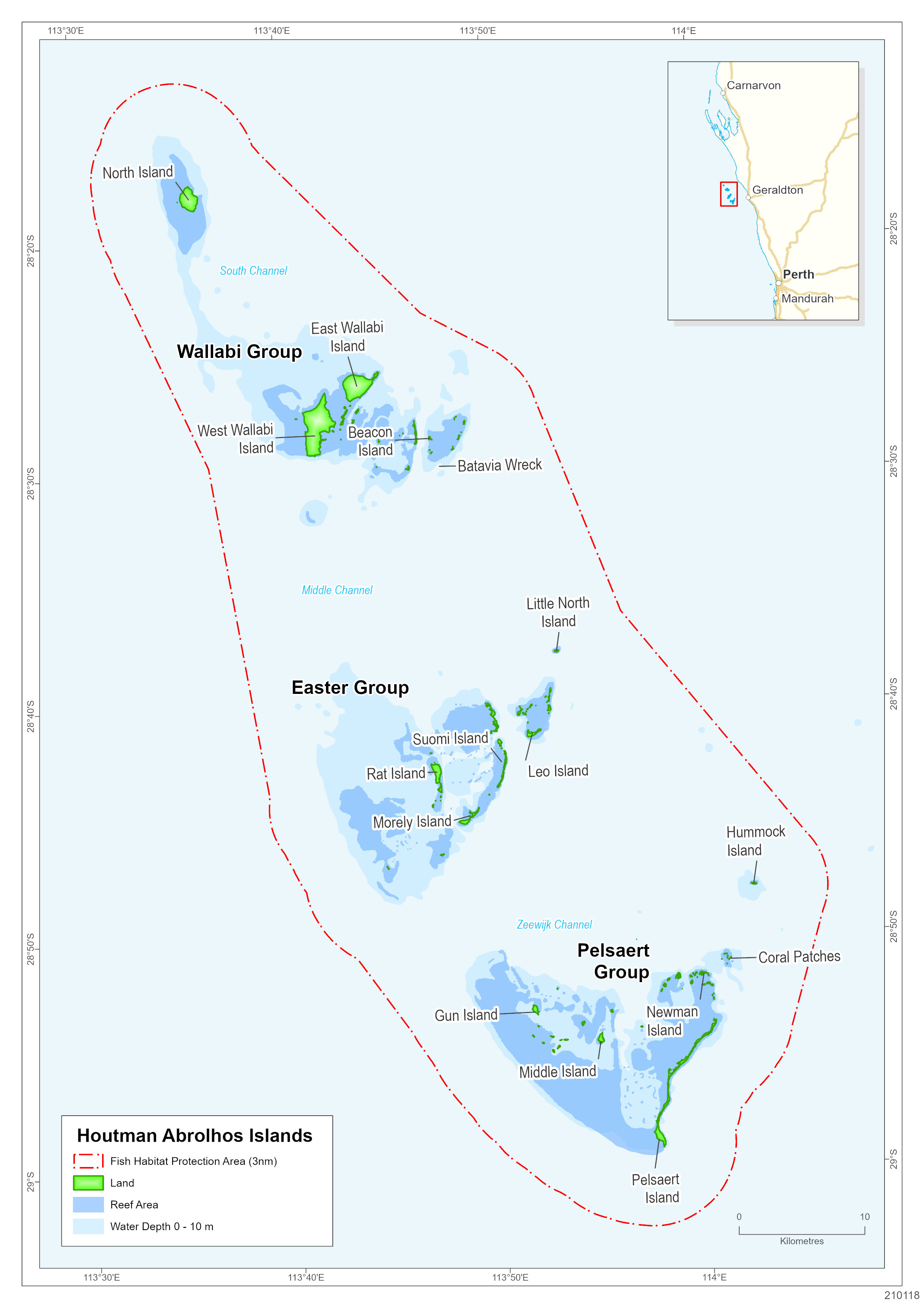
Map of the Abrolhos Islands
The Houtman Abrolhos Islands National Park (managed by the Department of Biodiversity, Conservation and Attractions) makes up approximately 97% of the total land area to the high water mark and includes most of the islands or parts of islands that are not leased to commercial rock lobster and aquaculture operators.
Maps of Reef Observation Areas, Abrolhos Reserve boundaries and Body Corporate Land Leases
- North Island Reef Observation Area
- North Island Abrolhos Reserve boundary
- Beacon Island Reef Observation Area
- West Wallabi Island Abrolhos Reserve boundary
- Pigeon, Little Pigeon and Alcatraz Islands Abrolhos Reserve boundaries
Wallabi Group maps
- Leo Island Reef Observation Area
- Leo Island Abrolhos Reserve boundary
- Rat, Bushby, Little Rat and Roma Islands Abrolhos Reserve boundaries
- Rat Island Body Corporate Land Lease
- Little Rat Island Body Corporate Land Lease
Easter Group Maps
- Map of Easter Group Reef Observation Area (4.61 MB)pdf
- Map of Little Rat Island showing Body Corporate Land Leases (3.43 MB)pdf
- Map of Leo Island Reserves (2.72 MB)pdf
- Map of Rat, Bushby, Little Rat and Roma Islands' Reserves (2.13 MB)pdf
- Map of Rat Island showing Body Corporate Land Leases (3.03 MB)pdf
- Coral Patches Reef Observation Area
- Pelsaert Group Islands Abrolhos Reserve boundaries
- Post Office Island Body Corporate Land Lease
- Coronation Island Body Corporate Land Lease