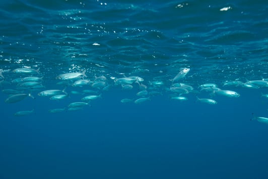
Freshwater Fish Distribution Map
Through the Freshwater Fish database, the department aims to provide other organisations and the community with up-to-date consolidated distributional information for native, introduced and invasive species that occur in freshwater and estuarine systems of Western Australia.
This can be used to inform and prioritise conservation, rehabilitation, invasive species eradication and control, and native fish restocking efforts across the state.
Launch the applicationStudents, scientists, resource managers and the general public can access information on the fish and crustacean species that reside in our local waterways using the map viewer. Users can query either by map, region or species, which will generate:
- a map of data collection points for the particular species, region or water body of interest
- a list showing all the species found in a designated catchment or water body, or;
- a table which lists all the waterbodies which the species of interest has been located
Contributions to the Freshwater Fish database are primarily provided by the department, as well as other agencies or organisations working under exemption from sections of the Fish Resources Management Act 1994.
The database is updated with new records that are collected by the department, researchers, other agencies and practitioners undertaking work which includes freshwater and estuarine fish sampling, stocking, and introduced fish control.
Building and maintaining such a comprehensive database is a significant task and can only be achieved with the help of other agencies, universities, environmental groups and individual researchers. If you have research data that has not been included in the Freshwater Fish database please contact us to contribute by emailing nativefreshwaterfishteam@dpird.wa.gov.au
If you have an invasive species sighting to report, call the WA FISHWATCH 24-hour Hotline 1800 815 507, or email Aquatic.Biosecurity@dpird.wa.gov.au.
The first iteration of the database was developed by the department (then Department of Fisheries) with the support of the Natural Resource Management Office (NRM), as part of the statewide Native Fish Strategy to identify the distribution, threats and management options for the conservation of native fish populations in Western Australia. The database did not capture information such as methods and effort that allowed for the measure of fish abundance over time, which is now available, increasing the usefulness of this database.
Our goal is to enhance the management and conservation of Native Freshwater fish and fish habitats in Western Australia by:
- increasing public awareness and appreciation for native freshwater fish and fish habitats in local waterways
- capturing and consolidating all available historical and future freshwater fish distribution data
- tracking the spatial and temporal distribution of native and introduced fish populations
- providing comprehensive up-to-date records of native and introduced species distribution to agencies, researchers and resource managers.
This information is specific to those person(s) working under an exemption under section 7 of the Fish Resources Management Act 1994, whose Instruments of Exemption include the condition to provide data for all freshwater and estuarine fish sampled within 6 months of sampling, to the department.
ArcGIS Organisational Account Holders
Details of all freshwater fish sampled must be recorded daily and entered into the Freshwater fish electronic Survey123 form.
If your organisation has recently obtained an ArcGIS organisational account, or has an existing account but you have not submitted data to the Freshwater Fish Distribution database before, please send details of your account including the username to NativeFreshwaterFishTeam@dpird.wa.gov.au.
Other Users
For all other Exemption Holders, an electronic Survey123 form can be completed, or an electronic log sheet (excel format) can be downloaded and submitted within 6 months of each sampling event, to NativeFreshwaterFishTeam@dpird.wa.gov.au.
A separate sheet will need to be completed for each activity, location and capture method.
Data to be captured:
Data records (including nil catch) must be submitted through either the Survey123 form online (see above section for the appropriate form relevant to your access) or in the specified Excel format via email. If these are not submitted completely to allow a seamless transfer into the Freshwater Fish Distribution database, the department will require the data to be submitted again in the correct format. Those who do not provide their data as per the condition on their instrument on exemption may be unable to obtain future exemptions until data is submitted correctly and completely.
The electronic data log spreadsheet is subject to change without notice. Check regularly for updates.
Any questions regarding the website or the data you are required to submit, please contact the Native Freshwater Fish Team’ via email: NativeFreshwaterFishTeam@dpird.wa.gov.au or leave a message with Reception on (08) 9203 0111.
The distributional records contained in the viewer are intended only as a guide. If you require detailed distributional information, please contact us. Note: requests for records will be subject to an approval process
Contact Us
-
Native Freshwater Fish TeamWestern Australian Fisheries and Marine Research Laboratories
39 Northside Drive
Hillarys WA 6025