The streamlined program allows for long-term data collection about recreational fishing collected, primarily from metropolitan Perth, to inform management decisions.
Three complementary survey methods are used in this program:
- boat ramp (access point) survey
- shore-based (roving creel) survey
- remote camera monitoring.
All 3 survey methods play an important role in providing information on different aspects of recreational fishing. The survey methods are supplemented by data collected from the statewide recreational fishing survey.
Survey methods used:
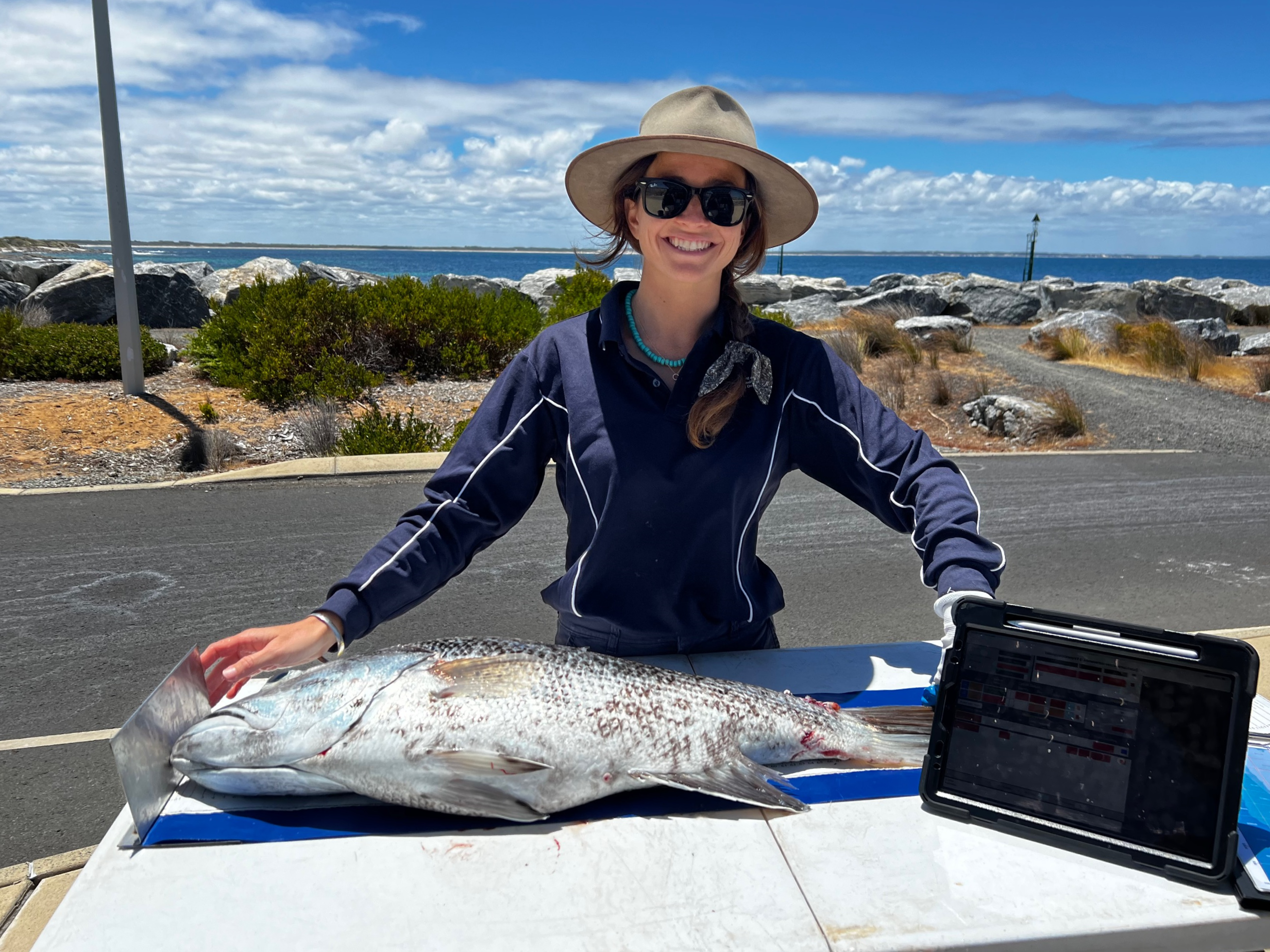
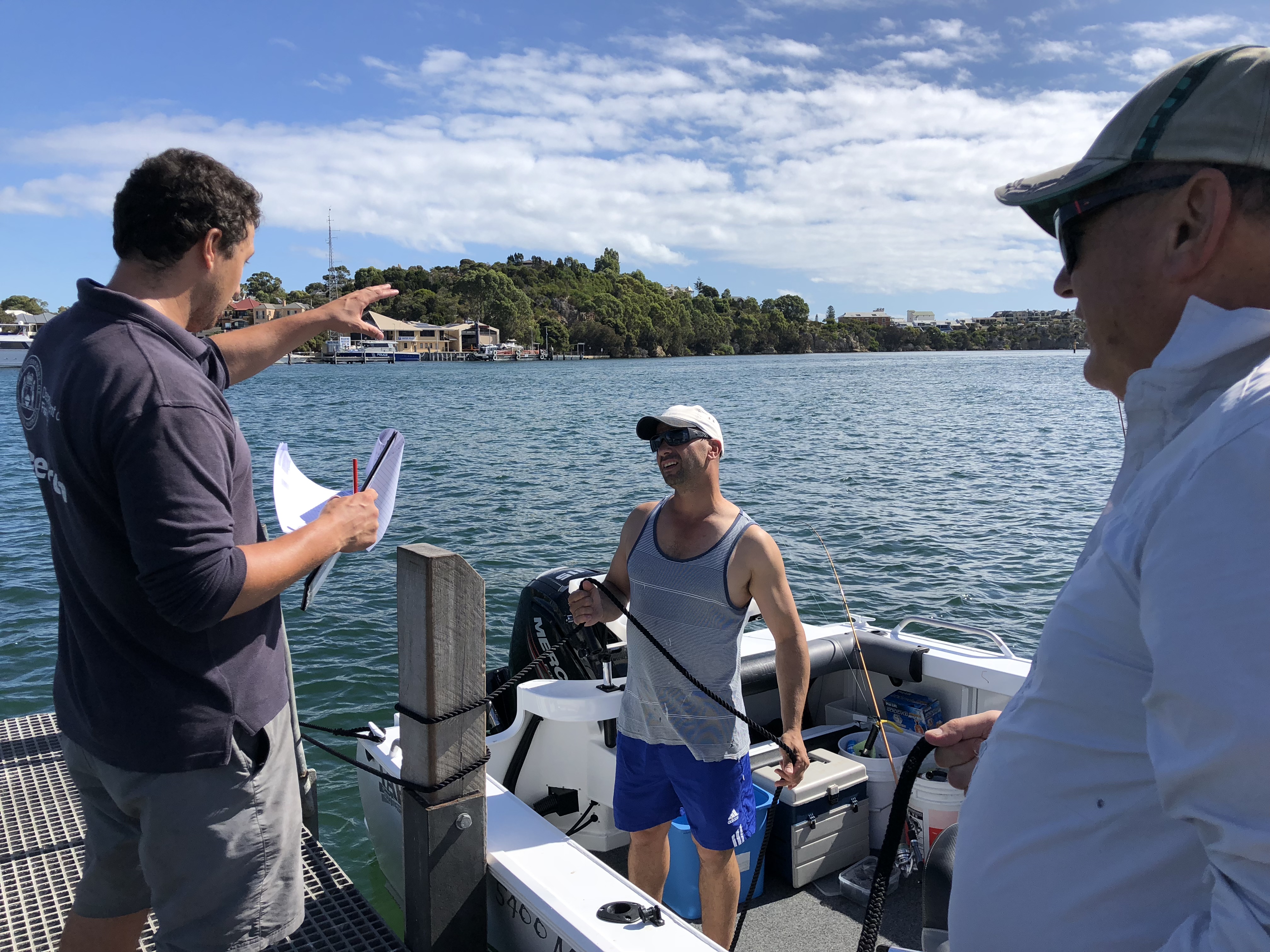
Boat ramp survey
The boat ramp survey is run annually and provides a measure of average weight and catch rate of species caught by boat-based recreational fishers. This includes nearshore, demersal, and pelagic finfish species, as well as crustaceans.
Who is being surveyed?
Boat ramp surveys involve face-to-face interviews with recreational fishers when they return to the boat ramp at the end of their fishing trip.
What information is collected?
During each survey, department researchers will introduce themselves and ask if recreational fishers can answer questions such as:
- the number of people in the fishing party
- what fishing gear was used that day
- what species were being targeted
- location fished
- how many fish were kept
- how many fish were released
- if they can measure and weigh any kept catch
- number of times they have fished in the last 12 months
- postcode of fishers
- age of fishers.
How is information collected?
Key boat ramps are surveyed during peak times of fishing activity to maximise the collection of biological information. Some randomisation is used when sampling to ensure data is not biased toward the biggest (or smallest) fishing boat or total catch. This is done by randomly selecting survey days and the fisher that we interview within the fishing party.
Nine of the boat ramps surveyed are in the West Coast bioregion, between Two Rocks and Mandurah, in metropolitan Perth.
An additional 6 ramps are also surveyed in the wider West Coast bioregion:
- Geraldton
- Dongara
- Jurien Bay
- Bunbury
- Busselton
- Augusta.
Shore-based survey
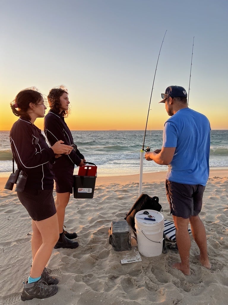
The shore-based survey is run annually and gives us a measure of recreational fishing effort, catch, average weight and catch rate, primarily for nearshore species, but also some demersal species.
Who is being surveyed?
In this survey, we conduct face-to-face interviews with recreational fishers while they are fishing on beaches, groynes, and reef platforms between Ocean Reef and Point Peron.
What information is collected?
In this on-site survey, department researchers record:
- the number of people in the fishing party
- what fishing gear was used
- what species were being targeted
- how many fish were kept
- how many fish were released
- measurements of a random selection of the kept catch
- number of times they have fished in the last 12 months
- postcode of fishers
- age of fishers.
How is information collected?
Department researchers travel along a predetermined route, stopping at each location for a specific wait time, and count the number of active fishers at each site. In addition, randomly selected fishing parties are interviewed. To reduce bias in our data, we use stratification by day type (weekend/public holiday or weekday) and time of day and randomise sampling by start location and direction of travel.
Remote cameras
Remote cameras operate 24/7 at eight key public boat ramps within metropolitan Perth. These cameras record the number of boat launches and retrievals over time.
What information is collected?
By counting the number of boat retrievals at a boat ramp, department researchers can determine the peak times of boating activity are and measure changes over time. This data also feeds into the planning of our boat ramp surveys to ensure surveys are scheduled during peak retrieval times.
Results from previous surveys
-
Metropolitan Monitoring Program 2024
-
Metropolitan Monitoring Program 2023
-
Shore-based recreational fishing in the Perth Metropolitan area: 2022
-
Shore-based recreational fishing in the Perth Metropolitan area: 2014 – 2021
Survey types and methods
Learn more about survey types and methods by downloading the factsheet.
DownloadContact Us
-
WA Fisheries and Marine Research Laboratories39 Northside Drive, Hillarys WA 6025, Australia